contact
contact
ForYou Club
4 °C
Webcam
5 / 13 Open facilites
Current info
Haus-Aich

Stoderzinken - Steinitzenalm | Dachstein Circular Hiking Trail: Stage 05

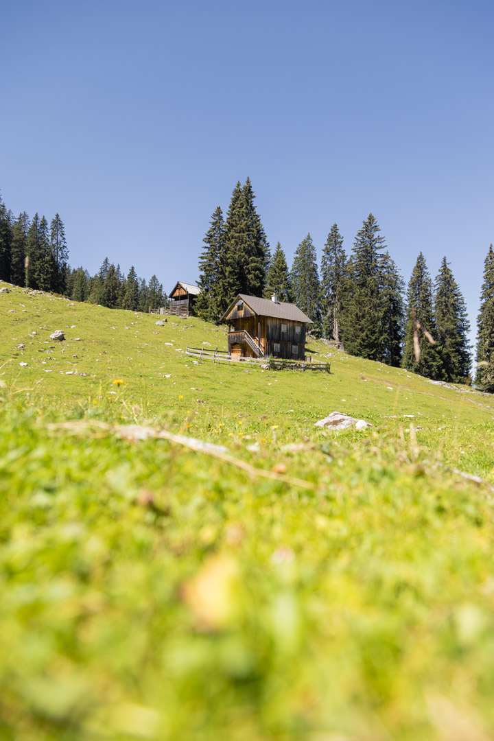
Steinitzenalm on the Dachstein Circular Hiking Trail
Hike on the Steinitzenalm
Steinitzenalm on the Dachstein Circular Hiking Trail
Historical rock engravings on the Stoderzinken
Summit cross on the Stoderzinken
Dachsteinmassiv at sunset
Viehbergalm - Ritzingerhütte
Hike by the mountain lake
Meadow near the Steinitzenalm

Tour description

The last part of the stage tour, which is still connected with steep ascents and descents. This stage leads us further into the valley. Here we find ourselves in a very busy area with several hiking trails.
 

The tour

difficult
publicly accessible
Starting point Steinerhaus - Stoderzinkne
Destination Steinitzenalm
Tour characteristics
Distance: 22.59 km
Fitness (5/6)
Skills (4/6)
Information
Distance: 22.6 km
Duration: 6:55 h
Ascent: 378 m
Descent: 1405 m
highest point: 1829 m
Best season
Jan
Feb
Mar
Apr
May
Jun
Jul
Aug
Sep
Oct
Nov
Dec

Map, elevation profile & further information

We go downhill from the Gasthof Steinerhaus and continue along path 618. We walk over big roots and uneven ground until to our right, below the Kimpflingsattel, there is a turnoff to the Notgasse of path 618. Here we have to take a close look, as the turnoff is signposted, but still easy to miss. From here we walk about 30 minutes to the actual Notgasse, an impressive gorge with up to 60m high rock faces and historical rock carvings. We follow the path through the gorge until we reach a forest path that we follow up to Brandalm. We continue along the path past the Viehbergalm into the forest - this section is also called "Bettlersteig". The path leading on is marked as a Dachstein circular hiking trail and leads over the summit of Hochmühleck and over the Goseritzalm always downhill through the forest to the Steinitzenalm.

Tip: At the Viehbergalm, traditional alpine huts invite you to stop for a bite to eat. The Ritzingerhütte also offers overnight accommodation.

This tour leads to alpine heights, so you should expect sudden weather changes. 

sturdy shoes, rainproof clothing, rucksack, enough supplies, sleeping bag if necessary

Sections of this stage are part of the northern route of the long-distance hiking trail "From glacier to wine".

Along the route

Wheather predicition

today
31.10.2026
Mountain 1 °C
Valley 9 °C
Snow
Mountain
5 cm
Valley
0 cm
Wind speed
Nord
10 km / h
Precipitation
Probability
90 %
Amount
6 l/m²
Sun
Sun hours
1.9 h
Sunrise
06:47 o clock
Sunset
16:50 o clock

Fair or bright in the beginning, cloudy towards the end of the day.

tomorrow
01.11.2026
Mountain -4 °C
Valley 5 °C
Snow
Mountain
3 cm
Valley
0 cm
Wind speed
Nord
15 km / h
Precipitation
Probability
90 %
Amount
2.9 l/m²
Sun
Sun hours
0.1 h
Sunrise
06:48 o clock
Sunset
16:48 o clock

Dull throughout the day with frequent, but fairly light snowfall.

day after tomorrow
02.11.2026
Mountain -1 °C
Valley 5 °C
Snow
Mountain
0 cm
Valley
0 cm
Wind speed
Nordost
10 km / h
Precipitation
Probability
40 %
Amount
0 l/m²
Sun
Sun hours
0 h
Sunrise
06:50 o clock
Sunset
16:46 o clock

The day will be dry, but mostly cloudy with occasional sunny spells.

Tours nearby